Description
Detailed information about Agriobs
Welcome to the Agriobs documentation page. Comprehensive documentation is a priority for Agriobs, but if you’re stuck please reach out to Ben via email ben@agriobs.com or phone +61428548688.
If you are an agronomist, farmer or other agribusiness seeking to use satellite imagery in your business, Agriobs will help you get the most of this valuable resource. Agriobs moves away from popular dumbing down satellite imagery to make it fit into the ’easy-to-use’ app category to enabling power users to get the extract more than value ever.
For those familiar with satellite imagery, the Agriobs features include:
With these features you can use satellite imagery for unlimited number of applications. Here are a few examples:
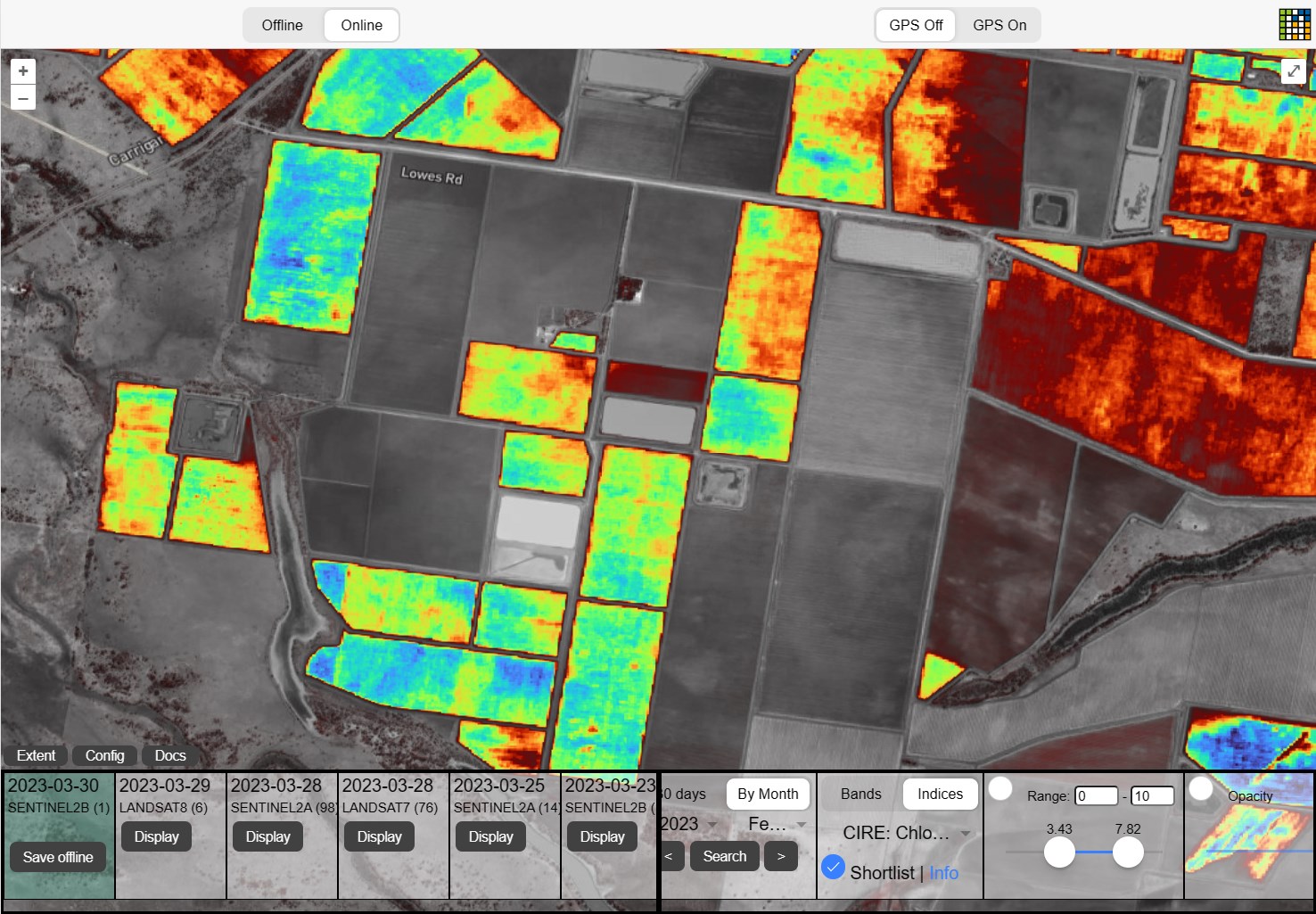
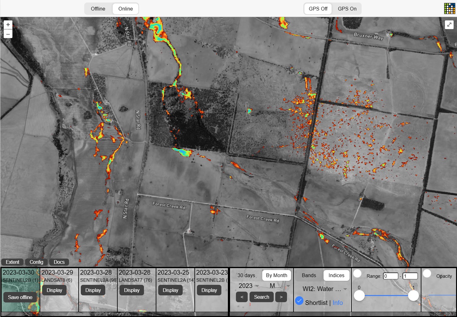
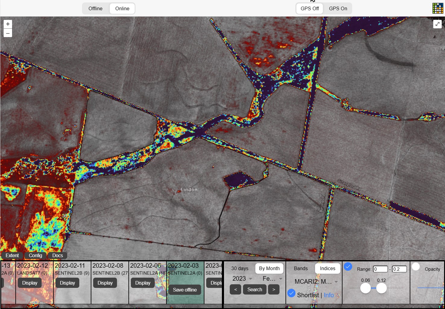
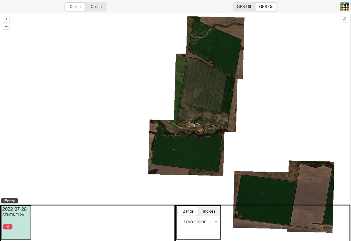
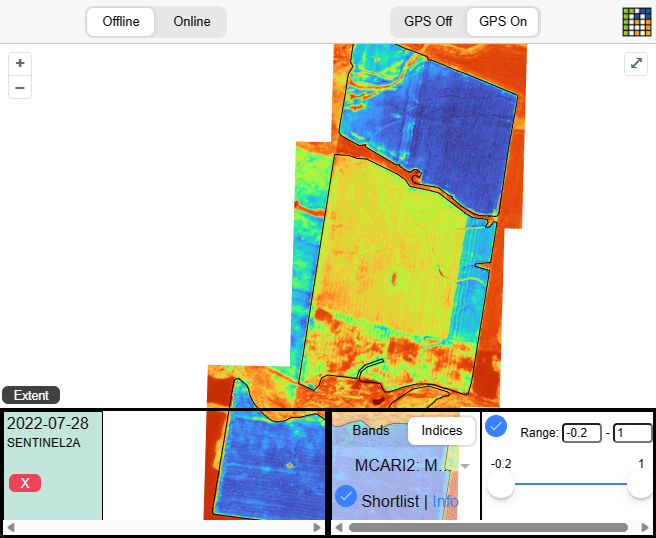
OK enough pictures - lets learn how to use this!
Agriobs is a PWA (Progressive Web Application) designed to install and run on almost any device - that is mobile, tablet and desktop.
Detailed information about Agriobs
Agriobs pricing information
Everything you need to know get up and running
See your project in action!
What does your user need to understand about your project in order to use it - or potentially contribute to it?
What can your user do with your project?
Show your user how to work through some end to end examples.
Low level reference docs for your project.
How to contribute to the docs
Was this page helpful?
Glad to hear it! Please tell us how we can improve.
Sorry to hear that. Please tell us how we can improve.